

Nancy Carrigain Loop – Hart’s Location, NH
Jun 09, 2025
Jerimy

Jerimy Arnold running through rare loamy singletrack.
Total Distance: 17.8 miles
Elevation Gain: ~5,125 ft
Estimated Time: 4.5 to 7 hours (running pace)
Difficulty: Hard
Route Type: Loop
Start/End Point: Sawyer River Road (Rt. 302, Hart’s Location, NH)
Best Time to Go: Late spring to early fall
Features: Alpine ponds, cascading waterfall, wilderness singletrack, 360° summit views, ridge-running
Overview
The Nancy Carrigain Loop is a challenging but rewarding mountain route that links the lightly-trafficked Nancy Pond Trail with the more popular summit of Mount Carrigain. This is one of my favorite routes in the Whites because it offers a little bit of everything without being as committing as some of the premiere routes.
Route Description
Sawyer River Road to Norcross Pond (Miles 0–5)
Begin at the Sawyer River Road parking area at the entrance of Sawyer River Road on Rt 302. This will let you knock out the road mile first and get warmed up. The Nancy Pond trail trail climbs steadily through dense forest with good footing and moderate grade. Around mile 3, you'll pass the remains of an old logging camp and shortly after reach Nancy Cascades.
Above the falls, the trail mellows and passes both Nancy Pond and Norcross Pond (it can be wet along this section). The latter offers a scenic backdrop Pemi wilderness views and a quiet alpine setting—arguably the highlight of the loop (it's essentially a giant infinity pool).
Norcross to Carrigain Summit via Desolation Trail (Miles 5–11)
After Norcross Pond, continue on the Nancy Pond trail and descend into one of the most beautiful pieces of trail in the Whites. A loamy evergreen tunnel will take you all the way to the Desolation Trail (Nancy Pond Trail turns into Carrigain Notch Trail), an excellent junction to refill your water and take a snack break. From here, you start your 2,000' climb up the Desolation Trail. It starts as a mellow gradient then makes a hard right up an elevator shaft of boulders. Overall, the Desolation trail is in great shape and is mostly a sidehill climb up Carrigain.
You'll emerge onto the summit at the base of the fire tower.
Carrigain Summit to Signal Ridge Trailhead (Miles 11–17.8)
After enjoying the panoramic views from the fire tower, descend via Signal Ridge Trail. The descent is a 2-mile consistent grade that is straightforward with a few rock gardens to navigate. Once off the ridge, it's 2.5 miles back to Sawyer River Road on very runnable trail and 2 miles down Sawyer River Road (dirt) to the Junction of 302.
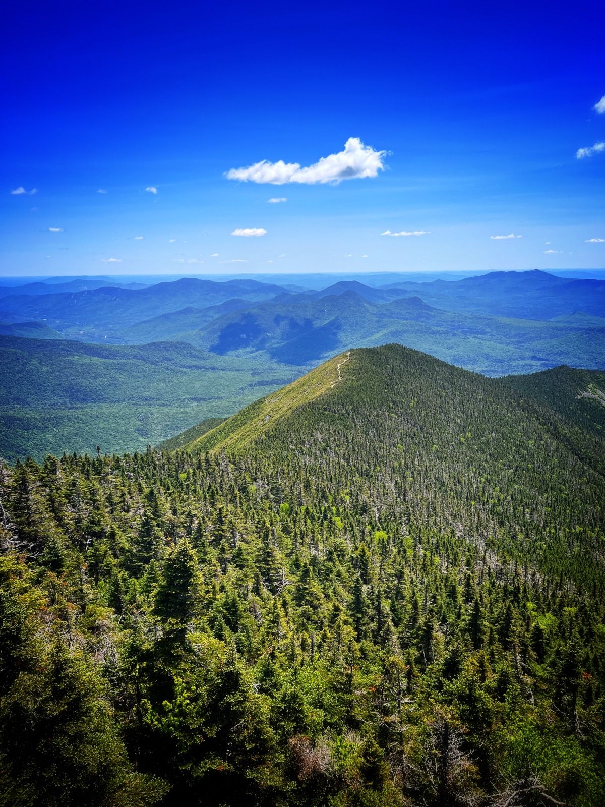
View of Signal Ridge from the Fire Tower.
